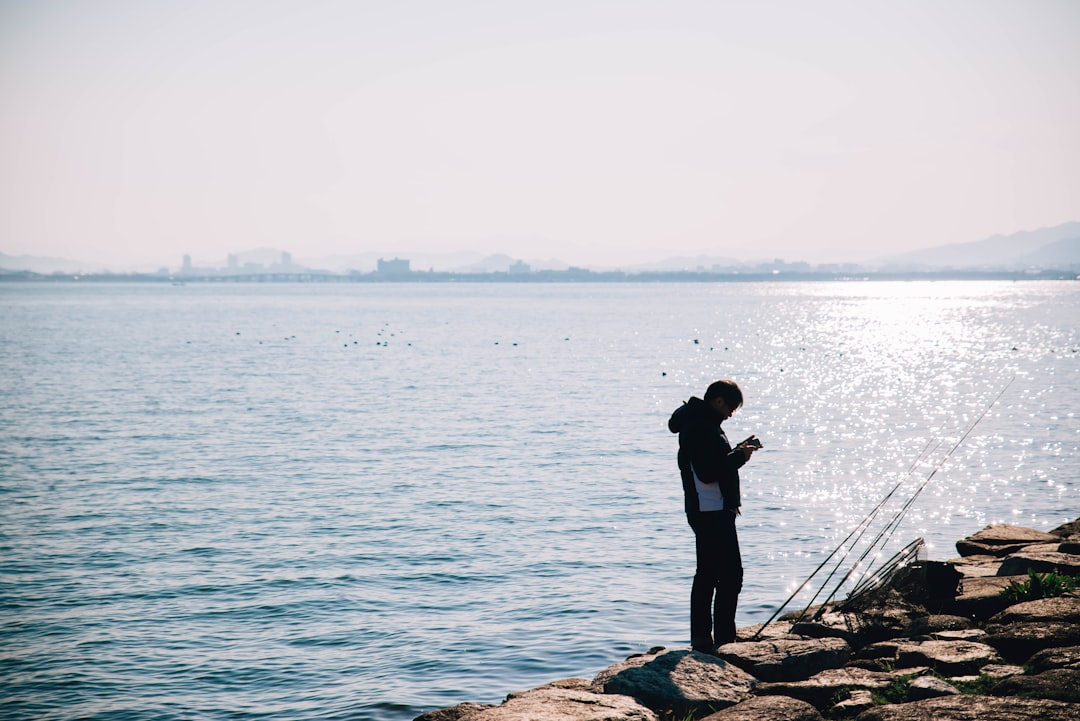
Modern angling is no longer guided by instinct alone. While skill, patience, and local knowledge remain essential, today’s most successful anglers increasingly rely on technology to gain a measurable edge. Fishing and angling apps combine weather data, satellite mapping, species intelligence, and community insights into powerful tools that can significantly improve catch rates on every trip. Used wisely, these apps transform guesswork into strategy.
TLDR: Fishing and angling apps help increase your success rate by delivering real-time weather data, solunar forecasts, GPS mapping, and local catch intelligence. They remove much of the uncertainty around choosing the right time and place to fish. The best apps combine mapping, species tracking, and social reporting to help you make data-driven decisions. When integrated into your planning and on-water workflow, these tools can dramatically improve consistency and results.
Why Technology Matters in Modern Angling
Fishing success often depends on variables outside an angler’s control: barometric pressure, water temperature, moon phase, wind direction, structure depth, and fish behavior patterns. Historically, these factors were tracked manually or learned through years of experience. Today, advanced mobile applications gather and interpret this data instantly.
Instead of asking, “Should I fish today?”, anglers can now ask, “When is the peak activity window today?” Instead of guessing where underwater ledges or drop-offs lie, detailed bathymetric maps reveal them precisely. Data reduces wasted time and increases confidence.
Core Features That Improve Catch Rates
Not every fishing app offers the same value. The most effective tools share several core features that directly impact success on the water:
- Solunar Forecasting: Predicts fish activity based on sun and moon positioning.
- Weather Integration: Real-time data on wind, barometric pressure, temperature, and precipitation.
- GPS Mapping: Detailed maps with contour lines, structure markings, and custom waypoint storage.
- Catch Logging: Records location, bait, weather conditions, and time of catch for pattern tracking.
- Community Reports: Localized catch data from other anglers.
- Tide Charts: Essential for saltwater and inshore anglers.
When combined, these features shift fishing from reactive to proactive. Anglers can anticipate movement patterns rather than waiting for random bites.
The Most Effective Fishing and Angling Apps
Below are several widely used applications that consistently deliver measurable improvements in planning and on-water execution.
1. Fishbrain
Best for community-driven intelligence
- Massive global catch database
- Species-specific bait recommendations
- Localized hot spot identification
- Personal catch tracking journal
Fishbrain excels at crowd-sourced insights. If multiple anglers are landing bass at specific depths using soft plastics on overcast mornings, that pattern becomes visible quickly.
Best for advanced mapping and navigation
- High-definition contour mapping
- SonarChart live mapping
- Route planning and depth shading
- Tide and current overlays
Structure attracts fish. Navionics reveals underwater humps, drop-offs, channels, and grass lines that often hold trophy species.
3. FishAngler
Best for free access to forecasts and maps
- Solunar forecasts
- Interactive map layers
- Local fishing reports
- Species detail database
4. iAngler
Best for structured catch logging
- Tournament tracking features
- Precise GPS catch markers
- Effort tracking and compliance reporting
5. Pro Angler
Best for saltwater regulations and identification
- Regulation lookup by state
- Offline species identification
- Tide tables and fish size references
Comparison Chart
| App | Best For | Forecasting | Mapping Detail | Catch Logging | Community Reports |
|---|---|---|---|---|---|
| Fishbrain | Local catch intelligence | Yes | Moderate | Advanced | Extensive |
| Navionics | Navigation and contours | Limited | Very High | Basic | No |
| FishAngler | Free all-around tool | Yes | Moderate | Yes | Strong |
| iAngler | Tournament tracking | No | Basic | Very Detailed | No |
| Pro Angler | Saltwater compliance | Tide Focused | Moderate | Limited | No |
Using Forecast Data to Time Your Trips
Fish are cold-blooded creatures influenced by their environment. Small environmental changes can produce dramatic shifts in feeding behavior. Solunar theory suggests that gravitational forces from the moon influence fish activity. While not absolute, this model often aligns with feeding windows.
Peak feeding periods typically occur:
- During major and minor solunar periods
- When barometric pressure begins to fall
- Shortly before a weather front
- Early mornings and late evenings
Apps that merge solunar predictions with localized barometric data offer valuable planning accuracy. Even adjusting your launch time by two hours based on forecasted activity can make a measurable difference.
Mapping and Structure: Where Success Is Built
Fish relate to structure. Whether targeting bass in freshwater lakes or snapper offshore, underwater depth variation and structure influence movement and feeding behavior.
Advanced mapping apps provide:
- One-foot contour intervals: Identifying subtle ledges
- Depth shading: Isolating target depth zones
- Sonar overlay: Custom charting based on your own passes
- Waypoint storage: Marking productive spots for repeat visits
By studying contours before launching, anglers can pre-plan drift routes, anchoring points, or casting angles. This structured approach eliminates random searching and preserves valuable daylight hours.
Tracking Your Own Data: The Overlooked Advantage
The most powerful analytics often come from your own history. Catch logging features allow anglers to track:
- Date and time
- Species and size
- Water temperature
- Lure or bait used
- Moon phase and pressure
Over time, patterns emerge. You may discover that smallmouth bass consistently strike jerkbaits in 52–55°F water when skies are partly cloudy. Those patterns are personal and far more reliable than generalized advice.
Saltwater vs. Freshwater App Considerations
Freshwater anglers should prioritize:
- High-resolution lake contour maps
- Water temperature overlays
- Seasonal pattern tracking
Saltwater anglers should prioritize:
- Accurate tide charts
- Current flow indicators
- State regulation compliance tools
- Offshore depth and wreck mapping
Environment dictates requirements. An offshore angler without current data risks wasted fuel and missed bite windows, while a lake angler without contour insight may overlook prime structure entirely.
Best Practices for Integrating Apps into Your Routine
Simply downloading an app does not guarantee results. Effective anglers integrate technology intentionally.
- Plan 48 hours ahead: Monitor forecast and pressure trends.
- Study maps before launching: Identify primary and backup locations.
- Log every catch: Even slow days produce valuable information.
- Compare community data cautiously: Use it as confirmation, not sole strategy.
- Download offline maps: Many fishing areas lack reception.
Discipline in data use separates serious anglers from casual users.
Limitations and Realistic Expectations
Apps enhance probability; they do not eliminate unpredictability. Fish are living creatures influenced by countless biological and environmental factors. Weather predictions can shift, local pressure can vary within small zones, and fishing pressure from others may alter behavior.
Technology should complement—not replace—core angling skills such as presentation accuracy, lure selection, patience, and observation.
The Future of Fishing Apps
Artificial intelligence and machine learning are beginning to shape modern angling tools. Emerging platforms analyze personal catch history and generate predictive suggestions. Integration with sonar devices, smart rods, and boat electronics is expanding rapidly.
Expect future developments to include:
- AI-driven bite probability scoring
- Real-time satellite temperature imaging
- Integrated drone scouting compatibility
- Hyper-local predictive modeling
As accuracy increases, the competitive edge will increasingly belong to anglers who interpret and apply digital insights effectively.
Conclusion
Fishing remains both art and science. Instinct, experience, and patience will always matter. However, in an era where environmental data, mapping precision, and community intelligence are instantly accessible, choosing to ignore these tools is a strategic disadvantage.
Fishing and angling apps provide significant improvements in timing, positioning, and decision-making. By leveraging solunar forecasts, high-definition mapping, catch logs, and community insights, anglers can systematically improve their success rate on every trip. Technology does not replace skill—it refines it. When used thoughtfully and consistently, these digital tools turn informed anglers into consistently successful ones.


