
Geospatial mapping platforms have fundamentally transformed how organizations visualize, analyze, and act on location-based data. From logistics optimization and urban planning to environmental monitoring and consumer applications, interactive maps are now essential decision-making tools. Platforms like Mapbox empower developers and enterprises to build highly customized, data-rich mapping experiences that go far beyond static maps. This article examines how modern geospatial platforms work, why they matter, and how leading solutions compare in terms of functionality, flexibility, and enterprise readiness.
TLDR: Geospatial mapping platforms such as Mapbox enable organizations to build dynamic, interactive maps that integrate real-time data, analytics, and custom design. These tools support industries ranging from transportation to finance by transforming raw location data into actionable intelligence. Compared to traditional mapping services, modern platforms offer greater flexibility, scalability, and developer control. Selecting the right solution depends on customization needs, data integration capabilities, and long-term scalability requirements.
The Rise of Interactive Geospatial Mapping
In today’s data-driven environment, location intelligence has become a competitive advantage. Businesses are no longer satisfied with static map images embedded on websites. They require interactive maps that:
- Display real-time traffic or asset tracking
- Integrate with internal databases
- Support 3D visualization
- Enable predictive modeling and analytics
- Provide seamless mobile and web experiences
Interactive geospatial mapping platforms allow organizations to overlay multiple datasets—such as demographics, sales territories, fleet routes, and environmental conditions—on a single, dynamic interface.
Image not found in postmetaAt the foundation of these platforms are geographic information systems (GIS), tile rendering engines, spatial databases, and APIs that allow sophisticated integration across applications. The most advanced solutions prioritize developer flexibility while maintaining enterprise-grade reliability.
Core Capabilities of Modern Geospatial Platforms
While feature sets vary, leading platforms share several critical capabilities:
1. Custom Map Styling
Customization is central to brand alignment and usability. Platforms such as Mapbox allow developers to design fully bespoke map styles, adjusting:
- Color schemes
- Typography
- Layer visibility
- Data emphasis and hierarchy
This level of control ensures that mapping interfaces align with product design standards rather than appearing generic.
2. Real-Time Data Integration
Modern mapping systems can ingest live data streams, including IoT sensor feeds, GPS tracking, weather patterns, and operational metrics. This is particularly valuable for industries such as:
- Transportation and logistics
- Ridesharing platforms
- Supply chain management
- Emergency response coordination
3. Advanced Geospatial Analytics
Geocoding, routing optimization, isochrone mapping, and spatial clustering allow organizations to extract meaningful insights from geographic data. These insights often drive efficiency improvements and cost reductions.
4. Scalability and Performance
High-performance tile rendering and global content delivery networks ensure responsive map experiences, even under heavy traffic conditions.
5. Cross-Platform Compatibility
Leading tools offer SDKs for web, iOS, Android, and embedded systems, ensuring consistent user experiences across devices.
Leading Geospatial Mapping Platforms
Below is a structured look at several prominent platforms used to build interactive maps.
1. Mapbox
Mapbox is widely recognized for its developer-first approach and extensive customization capabilities. Built on open-source foundations, it offers granular control over map styling and strong support for advanced features such as 3D visualization and augmented reality.
Strengths:
- Highly customizable vector maps
- Advanced routing and navigation SDKs
- Strong performance at scale
- Comprehensive documentation
Best suited for: Companies building location-driven applications that require unique branding and complex data overlays.
2. Google Maps Platform
Google Maps Platform provides a robust and globally recognized mapping infrastructure. It excels in data completeness and reliable geocoding accuracy.
Strengths:
- Extensive global geographic coverage
- Accurate real-time traffic data
- Street View integration
Limitations: Custom styling flexibility can be more constrained compared to Mapbox.
3. HERE Technologies
HERE Technologies focuses strongly on automotive, fleet management, and enterprise mapping solutions. It is known for high-quality routing algorithms and mapping precision.
Strengths:
- Advanced fleet management tools
- Strong automotive integration
- Offline mapping capabilities
4. OpenLayers
OpenLayers is an open-source JavaScript library for building interactive maps. It offers significant flexibility but typically requires more technical expertise.
Strengths:
- Open-source and cost-effective
- Highly extensible
- Broad plugin ecosystem
Comparison Chart
| Platform | Customization | Real-Time Data | Enterprise Scalability | Ease of Use | Ideal For |
|---|---|---|---|---|---|
| Mapbox | Very High | Excellent | High | Moderate | Custom apps and products |
| Google Maps | Moderate | Excellent | Very High | High | General business applications |
| HERE Technologies | High | Very Good | High | Moderate | Fleet and automotive |
| OpenLayers | Very High | Depends on setup | Depends on hosting | Low to Moderate | Custom open-source projects |
How Organizations Use Interactive Mapping
Geospatial platforms are no longer niche tools. They are foundational technologies across sectors.
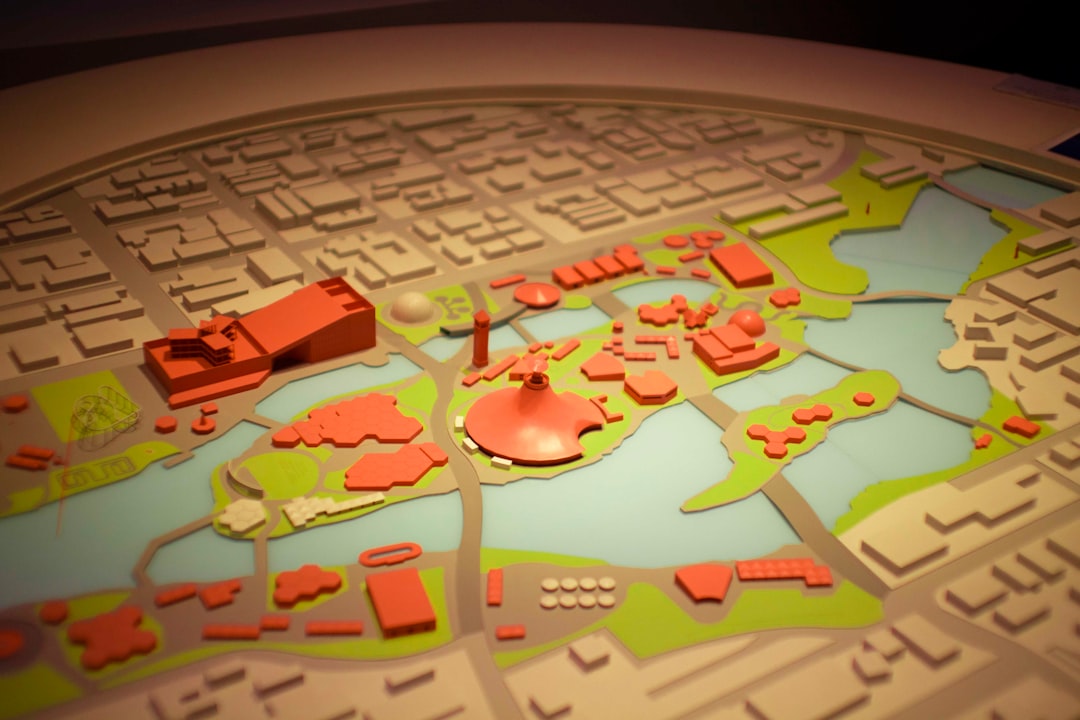
Urban Planning and Smart Cities
Municipal governments use mapping tools to visualize traffic flow, infrastructure projects, zoning regulations, and emergency response coverage. Interactive layers improve transparency and public engagement.

Logistics and Supply Chain
Delivery companies integrate mapping APIs to optimize routing, track packages in real time, and reduce fuel consumption. Predictive routing features help avoid congestion and improve on-time performance metrics.
Retail and Market Analysis
Retailers combine demographic data with store performance metrics to determine optimal expansion sites. Heatmaps and trade area analysis enable more informed investment decisions.
Environmental Monitoring
Environmental agencies use satellite overlays and real-time sensor data to monitor deforestation, flooding risks, and air quality levels.
The Technical Architecture Behind the Scenes
Modern geospatial mapping platforms operate through a series of interconnected components:
- Tile servers that render map data efficiently
- APIs and SDKs for developer integration
- Spatial databases for indexing geographic coordinates
- Cloud infrastructure for scalability and uptime reliability
Vector tiles have become particularly important, enabling smoother zooming and reduced data transfer compared to raster-based maps.
Security is also paramount. Enterprise deployments demand encrypted data transmission, access controls, and compliance with regional data protection regulations.
Key Considerations When Choosing a Platform
Selecting the appropriate geospatial mapping solution involves evaluating multiple factors:
- Customization Requirements: Does your application demand unique branding and advanced styling?
- Data Volume: Will your system process millions of map loads or real-time tracking updates?
- Budget Structure: Usage-based pricing models vary significantly.
- Integration Needs: Does the platform integrate easily with existing tech stacks?
- Long-Term Scalability: Can it support geographic expansion?
Organizations building complex, map-centric products often prioritize flexibility and control. Those embedding simple location features into web applications may emphasize ease of use and rapid integration.
The Future of Geospatial Mapping Platforms
The next generation of mapping platforms is likely to incorporate:
- Artificial intelligence for predictive traffic modeling
- Augmented reality navigation
- Enhanced 3D terrain visualization
- Indoor mapping integration
- Greater interoperability with digital twins
As IoT ecosystems expand and real-time data becomes more abundant, interactive mapping tools will serve as central operational dashboards for organizations of all sizes.
Conclusion
Geospatial mapping platforms such as Mapbox represent far more than technical utilities—they are strategic infrastructure components that enable data-driven decision-making. Whether supporting global supply chains, guiding autonomous vehicles, or visualizing climate data, these platforms convert raw geographic information into actionable intelligence.
Choosing the right provider requires careful consideration of customization capabilities, performance standards, and enterprise scalability. As industries increasingly rely on location-based insights, robust interactive mapping solutions will remain critical to innovation and operational excellence.
In an increasingly interconnected world, understanding and visualizing geographic data is not optional—it is foundational to staying competitive and informed.

 Is Revolutionizing Modern Urban Planning")

